
Travel Date: September 26, 2018
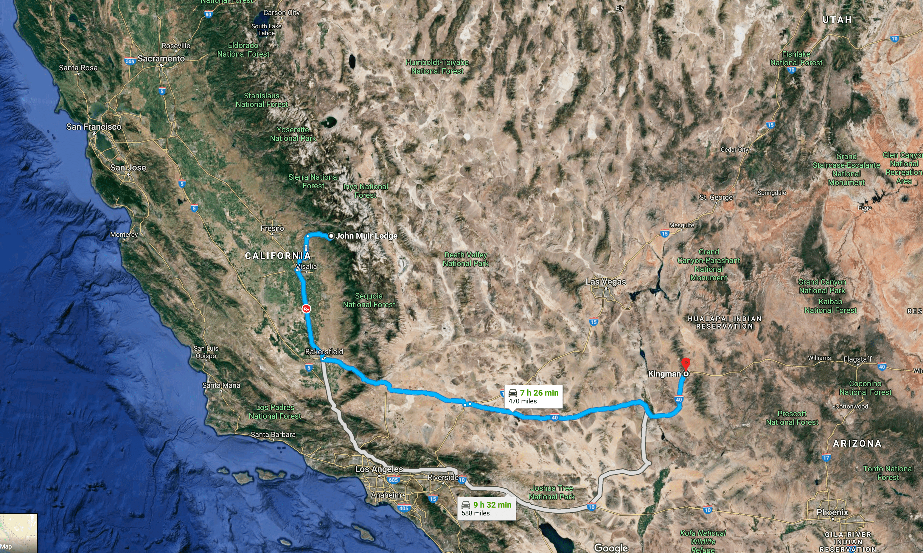
This would prove to be our longest travel day of the trip. After breakfast we packed up at John Muir Lodge in Kings Canyon and crossed over into the adjacent Sequoia National Park, then down the San Joaquin Valley and across the Mojave desert to Kingman, Arizona.

Our intention on the way out was to visit the General Sherman Giant Sequoia but we missed the turnoff. When we got to a place to turnaround we discovered that we were in the Grove of the Giants. Since there was a trail there – The Big Trees Trail – we opted for that. I grabbed a quick picture of Carla and Linda in front of the Sentinel Tree.
You may notice many of the sequoias in the photos have fire damage. Fire is actually good for the trees; the heat helps the seeds break out of the cone so they can germinate. In addition, the sequoias have thick bark and a resin that helps protect them.

The Big Trees Trail loops around a meadow that is ringed with sequoias.


The meadow is too damp to support the giant trees so they just live on the rim.
You may have heard the puzzle about what happens when an irresistible force meets an immovable object. Well, here is one result:

We knew we had to get moving so we grabbed a couple more photos and headed out.


Most – if not all – of the roads into the Sierra National Parks wind through the mountains; but Highway 198 heading west out of Sequoia National Park takes the cake. It looks like someone just scribbled on a piece of paper to mark the road.
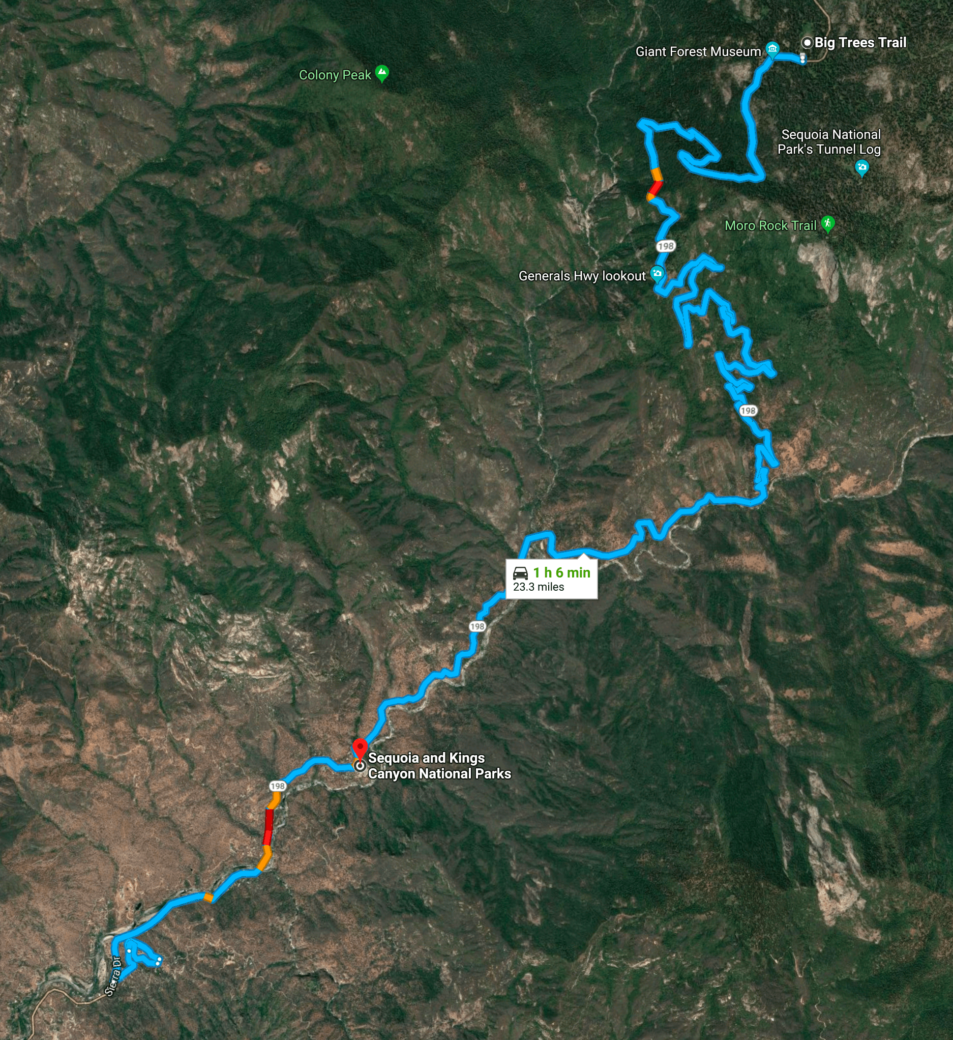
In reality of course the road has to follow the ridges down the mountains. It makes for slow going but there is lots to see, including Moro Rock. Interestingly enough, there is another Moro Rock on the central California Coast. I don’t know if there is a relation.

Eventually we reached Bakersfield at the south end of the San Joaquin valley where we stopped at an In ‘n Out for burgers and fries. I got to drive the next stage where we crossed over the Tehachapi Mountains – which I think of as the tail end of the Sierras – and into the Mojave desert: Mojave, Boron, Barstow and Needles.

If we didn’t have such a long day ahead of us we would have taken the old Route 66 National Highways trail. You can read about our previous drives here and here.
I love this stretch of road; it’s about 50 miles north of where I grew up – Palmdale, California – which is on the southern edge of the desert up against the San Gabriel Mountains. You can see from this Google Map snapshot what an effective job the Sierra NevadaMountain Range do at blocking moisture from going further east. The lush San Joaquin Valley is bounded by the mountains leaving desert on the other side. This is one of the things I remember from 5th grade when we studied our home state. I built a clay model of the San Joaquin Valley.
My dad worked out here in the desert for three different jobs. At the beginning of the space race he worked for the Jet Propulsion Laboratory at the north end of Edwards Air Force base. I was pretty young at that time so I don’t know what he did other than he was a test and measurement engineer. They would test rocket motors at a facility they called Rocket Hill. The rockets didn’t launch; it was a test facility to see how the engines would work. I remember on nights where they would test the engines my dad would take us up on the roof of our house with binoculars where we could see the rocket blasts 50 miles away. At a rest stop in Boron we were right next to the old Rocket Hill facility. It closed in 1994 I think. There are still some remnants.


Later he worked for Garrett Air Research – which initially had its test facility in Boron – as an engineer testing the tanks used to hold the liquid gasses for the Gemini and Apollo space craft. Then finally, as the aerospace industry faded he worked as a test engineer at the Boron mine in the same-named town. By then I was off in college and then married; so like when I was so young, I don’t have a clear idea of what his job was. My dad was a man who loved to measure, build, and test things. Tinkering with rocket engines, parts of space crafts, and machinery in an enormous mine were great jobs for him. He had a long commute from Palmdale to Edwards, and then Boron, but it wasn’t like today’s freeways; rather, it was over section roads through the desert.
We finished our drive through the desert, across the Colorado into Arizona and up into Kingman about 8:00 PM – twelve hours after we started our day. At this point we had driven almost 1,700 miles. We checked into our hotels for a good night’s sleep before the next day’s drive.
One thought on “Western U.S. Loop: Sequoia to Kingman”