
Date of Hike: July 1, 2023
You may remember our hike along Catherine’s Creek in the Columbia Gorge last Spring. It starts a little above river level and climbs about 1,000 feet to provide beautiful views of the Gorge. As I look back on it I remember three things – in order.
- It was BEAUTIFUL
- Linda and Jonah are much more fit and better hikers than we are.
- Along the way Carla and I both thought “well, I may have a heart attack, but at least it’s a beautiful setting.”
Bless Linda and Jonah, they asked us to join them on a hike up in the Gifford Pinchot National Forest of Washington. It’s about half way between Mount St. Helens and Mount Adams. Just about here…

Jonah assured us that it wasn’t as difficult as the our April hike. I thought to myself “Well, it can be a lot easier and still be tough.”; but I said “Sure! Let’s do it!”
As you can see on the map, it’s a ways away from Portland and not a lot of roads up there; but it is one of Jonah’s special places and we were happy he was going to share it with us. We started out just before noon at the Quartz Creek Trail head, and – if I remember correctly – hiked through the Upper North Fork Lewis River Falls, down past the Middle Falls Trailhead before ending up at the Lower Lewis River Falls.

It was a perfect day and the hike was mostly easy and beautiful. Unlike the Catherine’s Creek hike the elevation gain/loss wasn’t bad and the path was well maintained. But After awhile, the cement truck backed up – as in, it got hard. There was a small section where we had to scramble down a steep slope with a rock wall on one side, a drop off on the other and a fair amount of scree on the path. I thought to myself; “Okay, I won’t die of a heart attack here, I’ll just slip and fall down a hundred or so feet and break a few bones and wait in agony while the other three hike back up to the car, drive to a place with cell reception, call the rescue people to come and get me. Two hours, three tops.” But we scooted along our butts for a few yards and everything was fine. The path leveled out and we hiked along the river. I worry too much; It’s something I try to work on. Someone once told me that worry is interest on a debt you may not owe. Sure enough we made it down just fine.
We stopped by the upper falls for a few minutes to catch the view.


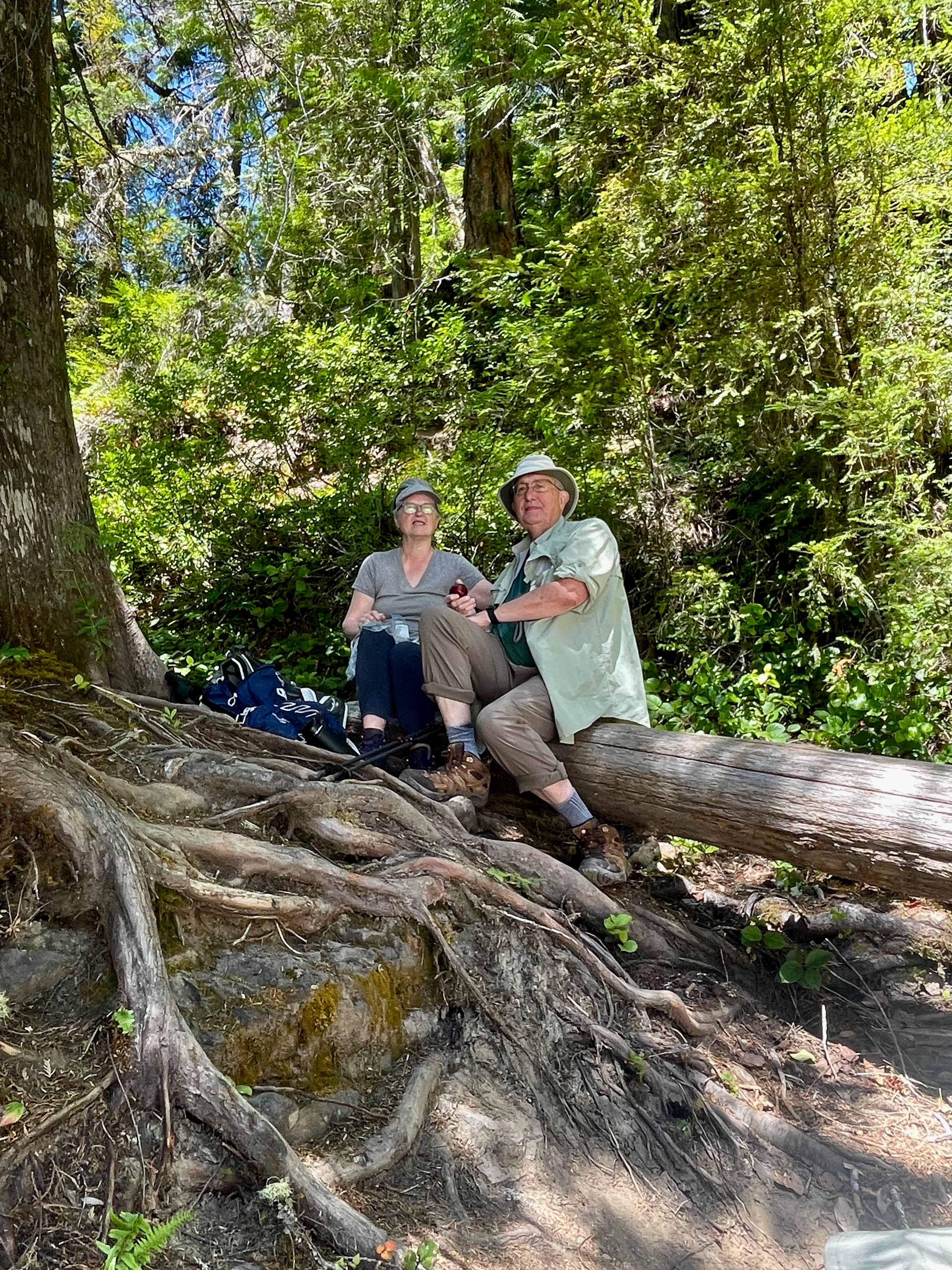
This seemed like a great time for lunch; so we ate. Here are Linda and Jonah.

What’s good for the goose is good for the gander; here are Carla and I enjoying lunch. Photo by Jonah.
As we continued south on the trail after lunch, we stop to get yet another angle of the Falls.

At this point we were pretty close to the river.

About 40 minutes after lunch – 2:00 PM – we reached the Middle Falls

If I recall correctly (and judging from the GPS of the image) we took a short side trip up Copper Creek to catch this waterfall.

Back on the main trail we reached the Lower Falls. You can get an idea of the scale by clicking on the image to get a larger view and zooming in to see the people on the far bank and the person in small boat under the falls.

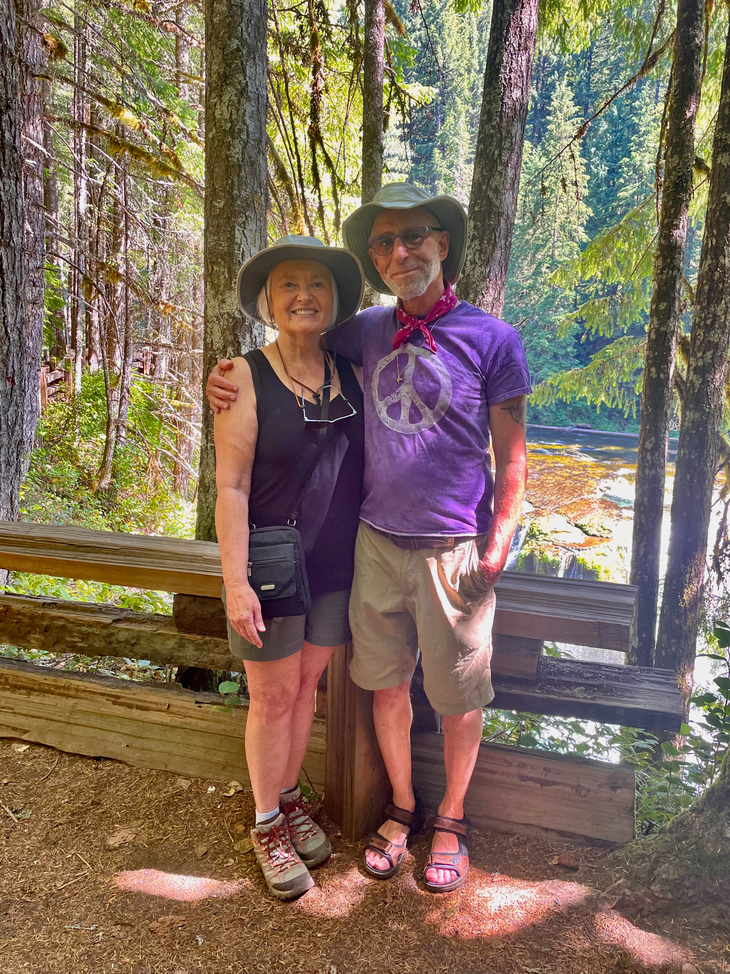
Jonah and Linda after the hike.
Now here is where you can see how much better shape Linda and Jonah are in. When we got to the Lower Falls trail head; they made Carla and I sit and rest while they walked the 2-3 miles along the road back to the car to come back to get us. I won’t lie; it was kind of embarrassing; I hope it doesn’t dissuade them from inviting us again. Going with them always results in stunning views. What a great day!
This ended up being about a three and a half hour hike on a beautiful day. I love any chance to hang with Jonah and Linda; getting this full day was a treat! Jonah, you are beautiful! On the way back, we stopped at a little cafe for the most delicious berry shakes. I forget if they were blueberries or blackberries. And I neglected to take a photo. Sorry.
A note about the photography here. I took some of the pictures with my Sony RX100M7; but most – including the one above – were taken with my iPhone 13. When it comes to waterfalls, I like to get the smooth water effect you achieve through long exposure. The long exposures I took with the RX100 ended up with completely blown out highlights. I tried to recover them in Lightroom – I tried using a radial gradient, a linear gradient, a range gradient, and even a brush. But the bright parts were just too bright to recover. As for the iPhone – either because it wasn’t a feature available on the previous iOS version, or I didn’t know about it – I couldn’t get the smooth water effect. But now I know how. First take the picture with Live View; then edit the picture and in the upper left corner of the image you’ll see “Live”, click on that and you’ll have some options; select “Long Exposure” and you’ll get that smooth water effect. Unfortunately I used to keep Live View turned off all the time. I’ve experimented with it but haven’t been near any running water recent so I don’t have any examples to share.
If you are hoping to pick Huckleberries, you’ll need a permit. Go the website at https://gp.fs2c.usda.gov/gp/ . Better to have a permit than to get caught with huckleberries in your hand.
There were no huckleberries, picked, packed, or consumed along the river. There may have been some in our milkshakes; if so, I hope the owners of the shake shop got them.
Why did the huckleberry blush?
Because it saw the raspberry dressing!